A land intelligence platform built for GYB Construction: draw a box on the map and SiteScan reads the parcels underneath it, zoning, access and demand, then suggests what to build and why.
GYB Construction's acquisition team was pulling zoning and parcel data site by site, with no fast way to compare dozens of parcels across a district on suitability, lot size or build type.
There was no single portfolio view of every site the team had already scanned, scored and shortlisted across past searches.
Screens below are the live product, not mockups.
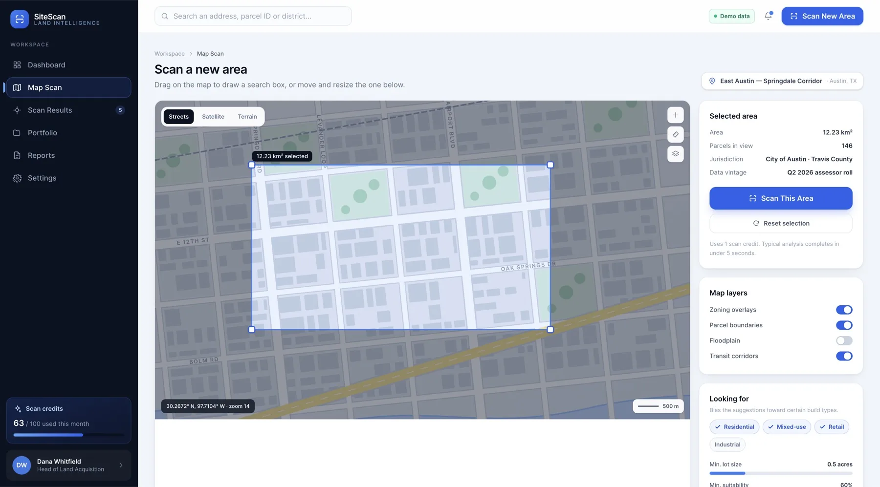
Drag a search area on the map and SiteScan reads every parcel underneath it: zoning envelope, access and demand signals, in seconds.
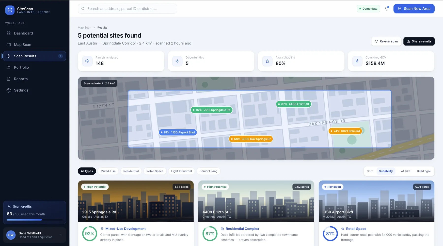
Each result comes back with a suitability score, suggested build type and lot size, plus combined GDV across the whole scanned area.
Areas scanned, parcels analysed, high-potential sites and average suitability score, tracked across every search the team has run.
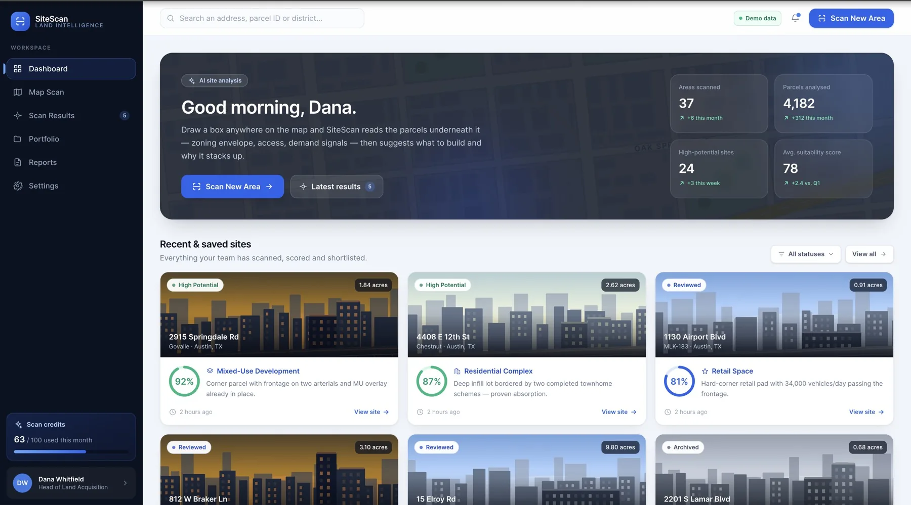
GYB Construction's acquisition team now draws a box on a map and gets a ranked, priced shortlist of parcels in seconds instead of days of manual research. A single recent scan surfaced 5 potential sites worth a combined $158.4M GDV, and the team's full portfolio now tracks 4,182 parcels analysed with 24 sites marked high potential.
Tell us what you are trying to solve and we will come back with a clear quote within 24 hours.
Get your quote